 The Runner Story
Introduction
Scouting and recceing ultra trail courses is one of the most effective ways for runners to prepare for demanding races. Understanding terrain, elevation profiles, aid station locations, and potential hazards can dramatically improve pacing, nutrition, and overall execution on race day. Whether you are tackling your first 50K or returning for a 100-mile event, a thorough reconnaissance plan turns unknowns into manageable challenges. Many first-time ultra runners underestimate how much the combination of steep climbs, remote sections, and variable footing can affect their performance. By investing time in reconnaissance, you build both physical familiarity and mental confidence that directly translates into smarter decisions during the event itself.
This guide covers proven methods using digital tools and real-world visits. It also addresses timing your recces, spotting bailout points, and accounting for 2026 seasonal conditions such as mud or snow. Runners who approach reconnaissance systematically often report finishing times that exceed their initial expectations because they have eliminated guesswork from their race strategy.
Why Course Reconnaissance Matters
Ultra trails often feature remote sections, technical terrain, and rapidly changing weather. Runners who skip reconnaissance frequently encounter surprises that lead to slower splits or DNFs. By contrast, those who invest time in scouting gain confidence and make smarter in-race decisions about effort and gear. For example, knowing exactly how long a particular descent takes allows you to conserve energy on earlier climbs rather than pushing too hard early on. Real-world data from past races shows that athletes who have previewed key sections reduce their risk of injury from unexpected terrain changes and improve their ability to manage hydration and nutrition at the right moments.
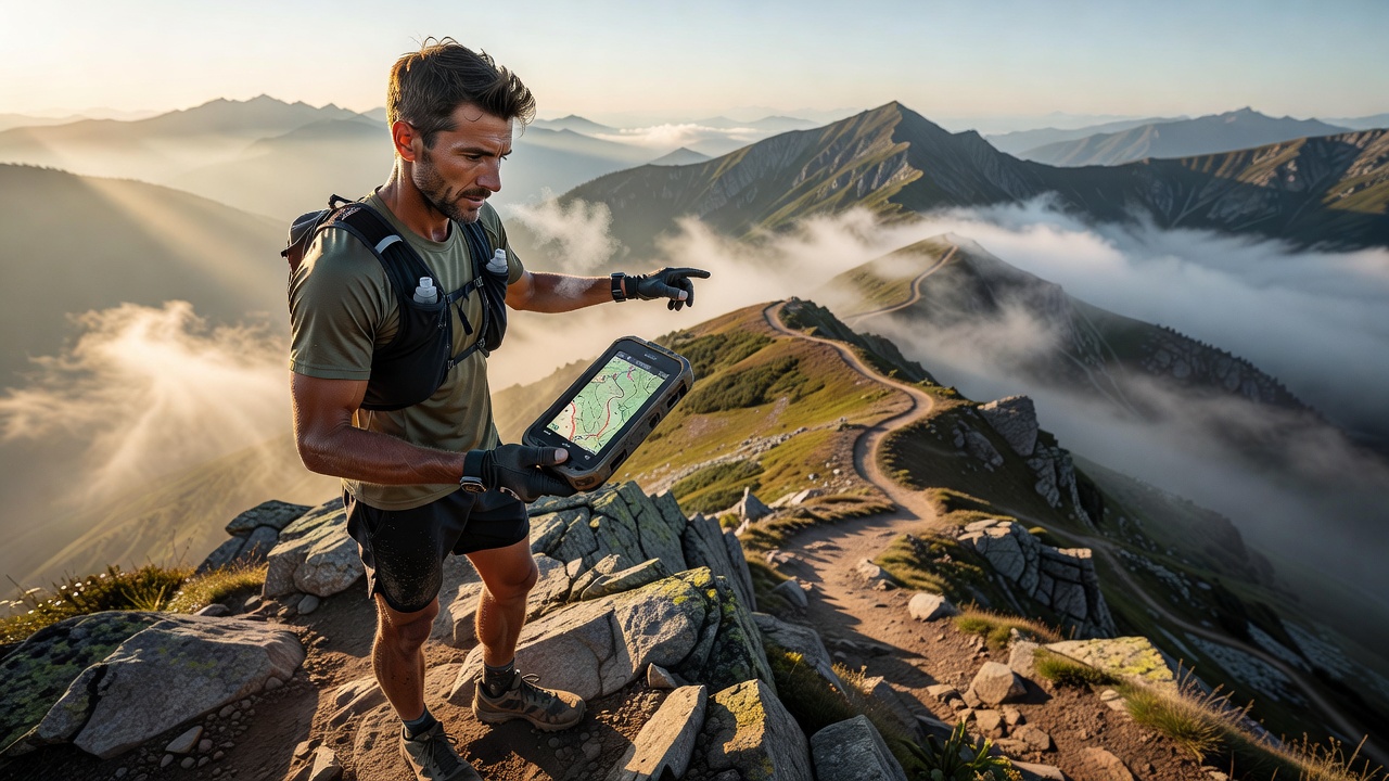
Digital Tools for Initial Reconnaissance
Begin with mapping and GPS applications to build a virtual understanding of the course. Popular options include Strava, Garmin Connect, and CalTopo. Upload the official GPX file provided by the race organizer, then analyze elevation gain, descent rates, and key landmarks. Cross-reference multiple sources because each app renders terrain data slightly differently. Strava offers heatmaps that reveal popular trail segments and typical speeds. Garmin Connect provides detailed climb breakdowns useful for estimating time between aid stations. Supplement these with satellite imagery to identify exposed ridges or dense forest sections that may affect navigation or temperature. Garmin also allows you to create custom courses and simulate race-day pacing scenarios, helping you identify where you might lose or gain time. Advanced users often layer weather data on top of elevation profiles to anticipate how wind or precipitation could impact exposed areas of the course.
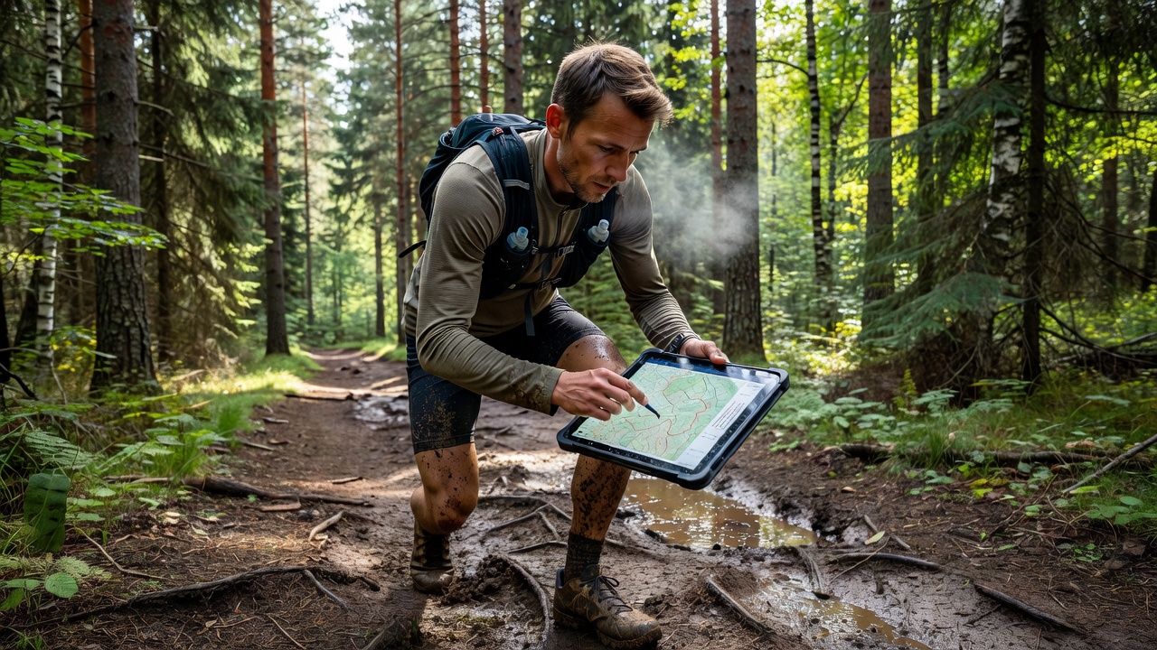
Planning On-Site Visits
After digital analysis, schedule physical visits. Prioritize sections with the highest elevation or technical difficulty. Drive or shuttle to trailheads when possible to maximize time on foot. Carry the same pack and nutrition you plan to use on race day to test comfort and accessibility. Document conditions with photos and voice notes. Note landmarks near aid stations, water sources, and potential hazards such as creek crossings or loose scree. This data becomes invaluable when creating a race-day strategy. Consider bringing a small notebook or using a voice recorder app to capture observations while they are fresh, including details like the exact distance between switchbacks or the feel of the trail surface under different foot placements.
Timing Your Recces and Seasonal Factors in 2026
Plan reconnaissance trips during similar seasonal conditions to race day. For events in late spring or early summer, visit in comparable months to observe snowpack or mud levels. In 2026, many mountain ultras may still encounter lingering snow above 2,500 meters into June, so check local trail reports before heading out. Early morning or evening visits help simulate low-light conditions. Avoid peak holiday weekends when trails are crowded and parking is limited. Multiple shorter trips often yield better insights than one long day. Pay attention to how vegetation changes throughout the season, as spring growth can obscure trail markers while late-season dryness may create loose gravel on descents that was not present during earlier visits.
Step-by-Step Scouting Checklist
Use this structured approach to ensure nothing is overlooked during your reconnaissance:
- Download and verify the official GPX file from the race website.
- Identify all aid stations and calculate cumulative elevation to each.
- Locate at least two bailout or escape routes per major climb.
- Photograph trail markers, signage, and any ambiguous junctions.
- Test footwear and traction devices on representative terrain.
- Record expected time splits based on observed effort levels.
- Note cell coverage dead zones for safety planning.
- Observe vegetation changes that may indicate wet or dry sections.
Review your checklist notes within 48 hours of each visit while details remain clear, then update your digital maps accordingly.
Real Runner Examples
Experienced ultra runner Maria Torres used three reconnaissance runs on the 2025 Cocodona 250 course. By noting exact locations of creek crossings that flooded after afternoon storms, she adjusted her pacing and finished 90 minutes ahead of her original goal. Similarly, veteran athlete James Kwon identified a hidden singletrack shortcut during a recce that saved him nearly 20 minutes on race day. Another runner, Elena Vargas, discovered during a pre-race visit that one aid station had limited crew parking, prompting her to adjust her support plan and avoid delays. These examples illustrate how small details uncovered during reconnaissance can compound into significant time savings and reduced stress.
Identifying Bailout Points and Aid Station Logistics
Every ultra course contains sections where continuing becomes unsafe. Mark bailout points on your map and share them with your crew. Confirm which aid stations offer crew access and which are runner-only. This information prevents confusion during long events when fatigue impairs decision-making. Create a simple spreadsheet listing each aid station with its distance, elevation, crew access status, and your planned time of arrival based on recce data. This document becomes a quick-reference tool on race morning.
Balancing Reconnaissance with Training Volume
Effective recces should complement rather than replace key workouts. Limit scouting days to recovery or easy volume days. Combine visits with long runs when the terrain matches your training needs. Keep total recce mileage under 15 percent of weekly volume to avoid overtraining. Schedule reconnaissance during weeks when your overall mileage is already lower so you maintain freshness for quality sessions later in the training block.
Common Mistakes to Avoid
Many runners make the error of trying to cover the entire course in a single trip, leading to rushed observations and fatigue. Others neglect to test their exact race-day gear during visits, resulting in uncomfortable surprises later. Avoid relying solely on one mapping app without cross-checking data, and never skip noting potential water sources or shade locations that could become critical in hot conditions. Finally, resist the temptation to push hard during every recce; treat them as information-gathering sessions rather than additional training intensity.
Frequently Asked Questions
How many times should I recce a course?
Most runners benefit from two to four targeted visits, focusing on the most challenging sections rather than covering the entire distance repeatedly. This approach keeps fatigue low while maximizing learning.
What if I cannot visit the course in person?
Rely on detailed GPX analysis, virtual flyovers, and reports from previous participants. Join race-specific forums and review recent finisher interviews for current conditions. Supplement with satellite imagery and elevation tools to build a solid mental model of the route.
Should I run or hike during reconnaissance?
Use a mix of both. Run runnable sections to test pacing, but hike steep climbs to evaluate effort and gear needs without excessive fatigue. This balanced approach mirrors how you will likely move on race day.
How far in advance should I complete my final recce?
Ideally finish your last detailed visit two to three weeks before race day. This timing allows you to incorporate findings into your final training while leaving enough buffer to recover fully before the event.
Conclusion
Thorough course reconnaissance transforms uncertainty into strategic advantage. By combining digital mapping tools, deliberate on-site visits, and a structured checklist, you will arrive at the start line prepared for whatever the trail presents. Invest the time wisely and your race execution will reflect the preparation. The insights gained from scouting often make the difference between a solid performance and a truly memorable ultra experience.

No comments yet. Be the first!