 The Runner Story

Introduction to Trail Navigation in Ultra Running
Ultra running demands more than physical endurance—it requires sharp navigation skills to handle remote trails, changing conditions, and long distances without losing your way. Effective trail navigation helps runners maintain momentum, conserve energy, and build the confidence needed for sustained efforts in events like 100-mile races. This guide covers essential tools, step-by-step planning methods, common pitfalls, and practice drills tailored for ultra runners. Whether you are preparing for your first 50K or pushing toward a multi-day ultra, mastering these skills reduces the risk of disorientation and allows you to focus on pacing and recovery.
Many runners underestimate how quickly a single wrong turn can add miles and hours to an already grueling effort. In 2026 endurance events, courses often wind through dense forests, high alpine zones, and unmarked singletrack where cell service is nonexistent. Building navigation proficiency starts with understanding both the tools available and the mindset required to use them under fatigue.
Essential Navigation Tools for Ultra Runners
Successful navigation starts with the right equipment. Traditional paper maps provide reliable backups when electronics fail, while GPS devices and apps offer real-time tracking. Popular choices include handheld GPS units and smartphone applications that work offline. Always carry a physical map of the race area as a failsafe, along with a compass for basic orientation. Waterproof map cases protect your paper resources from rain and sweat.
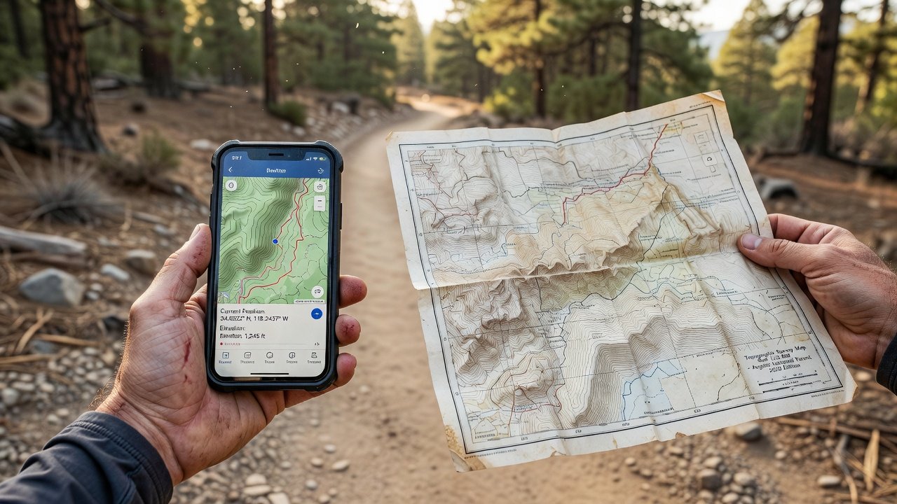
Compare digital and traditional methods in depth: Digital tools excel in speed and precision for quick route adjustments, but they depend on battery life and signal. Traditional maps require map-reading skills yet function in any weather. Many ultra runners combine both for optimal results. For instance, use a GPS watch to monitor distance and elevation while cross-referencing a folded map at each aid station. This hybrid approach minimizes errors when batteries drain or screens fog over during long night sections.
Step-by-Step Route Planning Techniques
Begin by studying the course map weeks in advance. Break the route into segments and identify key landmarks, elevation changes, and aid stations. Use online mapping platforms to plot waypoints and estimate times between points. Mark potential bailout routes and note areas with high navigation difficulty such as trail junctions or river crossings.
In real time, adjust by monitoring your position frequently and noting deviations early. Practice reorienting with a compass or app features to stay on track during races. Create a mental checklist: confirm your current location every 15-20 minutes, match visible terrain features to the map, and verbalize upcoming turns to yourself. This habit becomes invaluable when fatigue clouds judgment after 12 or more hours on the trail.
Common Pitfalls in Trail Ultra Running Navigation
Over-reliance on technology is one of the most frequent mistakes. Runners who follow a GPS track without glancing at surroundings often miss subtle trail markers and end up on parallel paths. Another common error is failing to download offline maps before the race, leaving devices useless when connectivity drops. Ignoring weather impacts on visibility and trail markers can also prove costly—rain can wash away flagging tape, while fog obscures distant peaks used for reference.
- Skipping pre-race reconnaissance of tricky sections, leading to hesitation at critical junctions.
- Neglecting to carry extra batteries or a portable charger for GPS devices during events longer than 12 hours.
- Assuming all course markings will be perfectly maintained, which is rarely true in remote wilderness areas.
- Overcorrecting after a small error instead of calmly backtracking to the last known point.
Actionable Drills for Navigation Practice
Incorporate these drills into weekly training to build muscle memory. Simulate race conditions by navigating unfamiliar trails with limited visibility using only a headlamp and map. Conduct map-only sessions on familiar loops to sharpen traditional skills without digital crutches. Practice quick GPS recalibrations during interval runs by intentionally deviating 200 meters and then returning to the original track. Join group trail runs focused on navigation challenges to learn from more experienced runners who can point out overlooked landmarks.
Another effective drill involves creating your own mini-courses: plot a 10-mile loop using only topographic maps, then run it while timing each segment. Compare your actual route against the planned one afterward to identify where small errors accumulated. Repeat this monthly to track improvement in both speed and accuracy.
Examples from Popular 2026 Endurance Races
Races like the Western States 100 and UTMB feature complex trail networks where navigation errors can add hours. Runners who master pre-planning and on-course adjustments often finish stronger. Study past race reports to anticipate similar challenges in upcoming events such as the Hardrock 100 or Cocodona 250. In these races, sections through high desert or mountainous terrain test both digital and paper navigation equally, rewarding those who have practiced in similar environments.
Weather-Related Navigation Challenges and Solutions
FAQ: How do I navigate in fog or heavy rain? Reduce speed, rely more on compass bearings and landmarks, and use waterproof map cases to keep paper resources readable. Cross-check your position against known trail features rather than distant views obscured by weather.
FAQ: What if GPS fails in storms? Switch immediately to paper maps and pre-marked routes. Carry a backup printed course profile with cumulative distances so you can estimate location even without electronic confirmation.
FAQ: How to handle snow-covered trails? Use GPS waypoints combined with visible trail blazes and poles for orientation. Look for subtle changes in vegetation or rock formations that align with your map contours when snow hides the actual path.
Conclusion
Mastering trail navigation transforms ultra running from a risky endeavor into a controlled, enjoyable experience. By blending tools, planning, and consistent practice, runners can tackle longer distances with greater assurance and fewer setbacks. Start integrating these skills today to prepare for your next endurance challenge. For more on outdoor safety, visit National Park Service, USGS, and U.S. Forest Service.

No comments yet. Be the first!